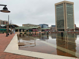
MyCoast Maryland App Launched
Help MD understand and address flooding by taking pix!
MyCoast: Maryland is a project of Chesapeake & Coastal Service & Maryland Department of Natural Resources. It is a mobile application portal to collect and analyze pictures and data relating to flooding caused by precipitation or coastal events.
Information collected through this site is used to visualize the impacts of flood events; to enhance awareness among decision-makers and residents of Maryland and to encourage action to reduce flood risks. Help to track nuisance tidal flooding, precipitation flooding, coastal storms, and restoration activities!
Join the Office of Sustainability in documenting floods in MD! Get started today by visiting: https://mycoast.org/md
Posted: May 25, 2021, 1:12 PM
